ADVERTISEMENT
All Property News
Stay updated with the latest real estate and finance news, including property market trends, housing insights, and valuable information.

Bina Puri defends early completion of Sarawak company acquisition amid Bursa query
14 hours ago

Chin Hin Group lifts stakes in Ajiya and Chin Hin Group Property via open and off-market acquisitions
15 hours ago

Sheng Tai judicial management bid stalls Infraharta's RM4.59 mil recovery effort
15 hours ago

KPKT revived 1,576 sick and abandoned housing projects since 2023, says Nga
18 hours ago

Encorp inks initial pact for Felda staff housing project
Yesterday

Myra Embun brings integrated living to Jenderam–Putrajaya growth corridor
Yesterday


.png?sNjuasipxlg5fTSjsjME58JKmvF7nf2I)


Shorts
View All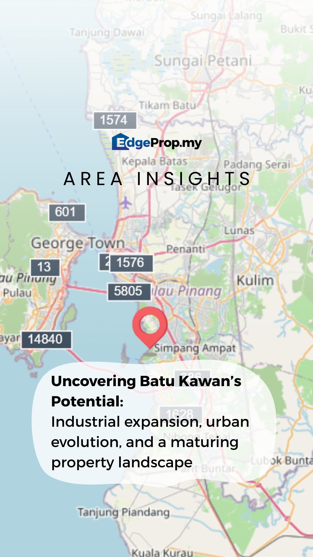
Just how fast is Batu Kawan's property landscape transforming? Keep watching to find out! This story first appeared in our April edition of our monthly publication. Subscribe for more exclusive deep dive on Malaysia's property landscape!

Everyone knows these buildings but not everyone knows what’s happening to them. Keep watching to find out!

EdgeProp is introducing “Generasi Baru” in partnership with SP Setia.

How are rising household incomes affecting where modern families choose to live?

It's official! We'd like to extend a big thank you to all of our partners for supporting the launch of our monthly publication, and for joining us for this mini-celebration! We'd also like to thank all the members of EdgeProp Malaysia, without whose efforts and hard work, would never have materialised this vision.


.jpg)


Malaysia's Most
Loved Property App
The only property app you need. More than 200,000 sale/rent listings and daily property news.
